
TROPICAL DRY FOREST RESEARCH CENTER AND BIOLOGIAL STATIONS
Four biological stations and a reseach center have been established and located in different climate zones, with the object of promoting and facilitating the work of researchers, students, ecotourists, and organized groups, whether they be national or international.
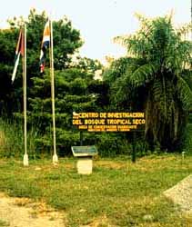
TROPICAL DRY FOREST RESEARCH CENTER
A well marked dry season (november-may), high temperatures, intermittent
rivers, deciduous forests and a high diversity of organisms, identify Tropical
Dry Forest.
This forest used to extend throughout the Pacific Coast of Mesoamerica,
but is found today much reduced in small patches in the region. Of the 80,000
ha of dry forest that are found in the ACG, one of the blocks in the greatest
stage of regeneration is the Santa Rosa Sector.
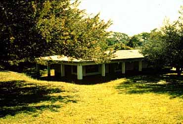
The Tropical Dry Forest Research Center, created in 1992, with the object
of creating better conditions for the development of the activities of researches
and students, is located at this site.
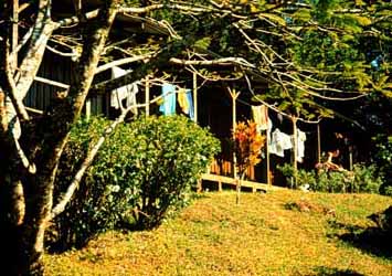
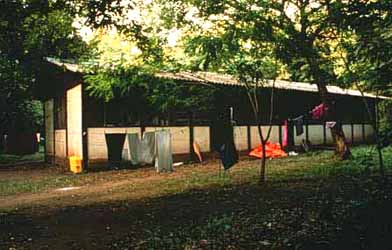
The Research 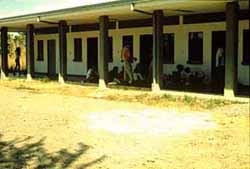 Center counts on five building,
divided into dormitories for groups with a 64 person capacity, a hostel
for resident researchers, a laboratory, a laundry room, and an administrative
office where the conference room, the Documentation Center and the offices
for the Research Program, Computer Support, and the Admistration of the
Research Center and the Biological Stations, are located.
Center counts on five building,
divided into dormitories for groups with a 64 person capacity, a hostel
for resident researchers, a laboratory, a laundry room, and an administrative
office where the conference room, the Documentation Center and the offices
for the Research Program, Computer Support, and the Admistration of the
Research Center and the Biological Stations, are located.
In the Santa Rosa Sector, near the Research Center, the Administration of the Area de Conservación Guanacaste, which also has the main offices of the Directorate, Accounting, Human Resources, Ecotourism, Biological Education and Sectors.
The facilities tied to the Research Center and which function as support
for th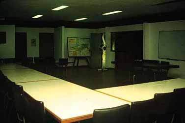 e different users of the Center
are: a dining hall, electricity, drinking water, telephone, fax, and photocopier.
e different users of the Center
are: a dining hall, electricity, drinking water, telephone, fax, and photocopier.
To get to the Center you have to travel 35 kms to the northeast of the
city of Liberia on the Interamerican highway, or 24 kms south of the city
of La Cruz on the same highay; until you get to the entrance of the Santa
Rosa Sector (which used to be called Santa Rosa National Park), and from
there you continue on a paved road for about 7 kms until you reach the Research
Center.
 This upper elevation site, Sector
Cacao at 800-1400 m elevation, is reached by driving 9 km east from Potrerillos
on the Interamerican Highway (where it is crossed by the Rio Tempisquito)
to the town of Quebrada Grande (called Garcia Flamenco on old maps). Potrerillos
lies 25 km north of Liberia. Take the gravel road out of the north corner
of Quebrada Grande (heading east toward the small town of Dos Ríos
on the Caribbean side of the ACG). 1 km out of town take the first (only)
dirt road north (left), which continues 3 km north to the tiny bridge over
the Río Gongora, which is the southern boundary of the ACG. From
here, the access is only by 4-wheel drive vehicles, and some portions of
the road can be impassibly slippery for periods during the rainy season.
Continue north on a primitive track across open (gradually regenerating)
pastures, through several gates, to the road end at Los Naranjos (900 m,
Rio San Josecito), where the unbroken forest begins up the southwest slope
of Vólcan Cacao. From Los Naranjos, the broad trail winds through
primary intermediate elevation rainforest (Los Arenales) for about 1 km
to the Cacao Biological Station (CBS) at 1000 m elevation, on the uphill
side of a 20 ha pasture cut out of the forest (and destined to remain pasture).
Heavy objects are transported from Los Naranjos to the CBS by ACG horses
that pasture at the CBS.
This upper elevation site, Sector
Cacao at 800-1400 m elevation, is reached by driving 9 km east from Potrerillos
on the Interamerican Highway (where it is crossed by the Rio Tempisquito)
to the town of Quebrada Grande (called Garcia Flamenco on old maps). Potrerillos
lies 25 km north of Liberia. Take the gravel road out of the north corner
of Quebrada Grande (heading east toward the small town of Dos Ríos
on the Caribbean side of the ACG). 1 km out of town take the first (only)
dirt road north (left), which continues 3 km north to the tiny bridge over
the Río Gongora, which is the southern boundary of the ACG. From
here, the access is only by 4-wheel drive vehicles, and some portions of
the road can be impassibly slippery for periods during the rainy season.
Continue north on a primitive track across open (gradually regenerating)
pastures, through several gates, to the road end at Los Naranjos (900 m,
Rio San Josecito), where the unbroken forest begins up the southwest slope
of Vólcan Cacao. From Los Naranjos, the broad trail winds through
primary intermediate elevation rainforest (Los Arenales) for about 1 km
to the Cacao Biological Station (CBS) at 1000 m elevation, on the uphill
side of a 20 ha pasture cut out of the forest (and destined to remain pasture).
Heavy objects are transported from Los Naranjos to the CBS by ACG horses
that pasture at the CBS.
From the CBS a broad trail winds up through the primary forest to 1400
m at the Derrumbe site, and a narrower steep footpath winds up to the summit
at 1550-1650 m. This very fragile and small habitat requires permission
for use. This gradient from intermediate elevation seasonal evergreen forest
to cloud forest on the summit of Volcan Cacao is extremely steep. Equally
steep is the gradient from intermediate elevation forest to the dry forest
on the lower western slopes of Volcan Cacao, directly west of the CBS and
below the fire lookout house on the top of Cerro Pedregal (1000 m). The
CBS provides excellent access to the kind of forest that grew many centuries
ago on what are today's coffee fincas around Grecia, Alajuela and Heredia.
A broad trail extends from the CBS down to the Maritza Biological Station.
The CBS dormitory, with 4 toilets and 2 showers, has beds for 32 people
in four rooms (a small house with bathroom can accomodate a few more). The
Sector Caretaker's house doubles as kitchen and dining hall for researchers
and groups. The research laboratory is a moderate-sized building with tables
and blackboard. The building complex can rustically accommodate a field
biology course or moderate-sized group of ecotourists. With advance reservations,
the ACG can provide meal services and bedding at the CBS for groups or individuals
for moderate prices. There is no electricity, but there is ample running
water. Heavy clouds and rain can dominate for many weeks during the rainy
season, and winds can be strong. Nights can be as cool as 14-16 C°.
This interface between the dry forest and Pacific slope rainforest at 500-600
m elevation, Sector Orosí, is reached by driving 14 km east on a
dirt road from the intersection of the Interamerican Highway with the paved
road to Cuajiniquil (9 km north of the entrance to sector Santa Rosa). This
road is easily passable in dry weather with 4-wheel drive, but during rainy
periods requires considerable skill to pass the mud-holes. After unusually
heavy rains, three streams that cross the road may be impassable for several
hours.
The Maritza Biological Station (MBS) lies on the western foothills of
Vólcan Orosí (1450 m) (not to be confused with the Orosi area
in the vicinity of Paraiso to the east of Cartago, Costa Rica, a site of
much collecting activity around the turn of the century). 80 m south of
the MBS flows the headwaters of the Río Tempisque (here called Río
Tempisquito), which drains into the Pacific. 200 m north of the MBS flows
the Río Sapoa (here called Quebrada Jorco), which empties into Lake
Nicaragua and thence to the Atlantic.
The MBS has been developed jointly with the Strout Aquatic Research Laboratory
of the Philadelphia Academy of Natural Sciences to serve as an aquatic biology
research station. It also provides excellent access to the regenerating
interface between lowland dry forest and the undisturbed evergreen but strongly
seasonal forests extending upslope to the cloud forests on Volcan Orosí
and Volcan Cacao. A well-defined trail extends across this transition up
to the Cacao Biological Station at 1000 m elevation. The MBS receives 2000-4000
mm of rain during the May-December rainy season, and is often very windy.
The MBS dormitory houses 32 people in four large rooms, with showers
and bathrooms, and 24-hour electricity (110 v). The large research laboratory
and classroom, and adjacent multiuse building, can comfortably accommodate
a field biology course or moderate-sized group of ecotourists. With advance
reservations, the ACG can provide meal services and bedding at the MBS for
groups or individuals for moderate prices. The Sector Caretaker's house
doubles as kitchen and rustic dining hall. The MBS resident biologist house
may also be able to accommodate a few long-time researchers.
This Caribbean slope foothill rainforest site, Sector Pitilla (400-800
m), is reached by driving 35 km east to Santa Cecilia from the government
checkpoint on the Interamerican highway about 4 km south of La Cruz (22
km north of the entrance to sector Santa Rosa). At Santa Cecilia, turn south
on the (only) road to Upala, and at ap proximately 2
km, at the end of the orange plantation, turn west (right) on the first
dirt road. This road enters the ACG after 3 km and after 4 km more, ends
at the Pitilla Biological Station, which lies at the northeast corner of
the ACG. It is passable with a 4-wheel drive vehicle, except after some
rains, but when it is wet it requires a driver with substantial experience
on small dirt roads.
proximately 2
km, at the end of the orange plantation, turn west (right) on the first
dirt road. This road enters the ACG after 3 km and after 4 km more, ends
at the Pitilla Biological Station, which lies at the northeast corner of
the ACG. It is passable with a 4-wheel drive vehicle, except after some
rains, but when it is wet it requires a driver with substantial experience
on small dirt roads.
The PBS (600 m elevation) lies at the interface of a several thousand ha of regenerating forest 1-80 years old, pastures, and 10,000 ha of primary rainforest to cloud forest that has been disturbed only by earlier light hunting and the occasional severe wind storm. Immediately to the west of the station, the volcanic foothills rise to the top of Cerro Orosilito (1100 m) and then drop down into the Rio Mena, to again rise steeply to the top of Volcan Orosí (1450 m). Sector Pitilla is one of the most species-rich sites in Costa Rica. Approximately 4 m of rain falls between May and February, and even the 2 month dry season remains moist. About 12 km of trails provide easy access to representative habitats, but the area is largely unexplored.
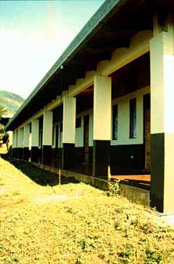
The two-room dormitory has 20 beds (expandable to about 30 by sleeping
on floors) with 3 showers and toilets, adjacent to broad roofed porches
and corridors for laboratory work and classroom activities. There is no
electricity, but there is ample clean water for showers and drinking. The
kitchen (gas stove, no refrigeration) can be used by individual researchers.
With advance reservations, the ACG can provide meal services and bedding
for groups or individuals for moderate prices. The PBS is occupied full-time
by the Sector Caretakers and resident parataxonomists.
 Playa Nancite is reached by driving southwest from the
ACG Administration Area for about 6 km down to the bottomlands behind Playa
Naranjo, and turning northwest (right) at the fork, and driving about 4
km further. About 200 m before reaching the end of the road in the Estero
Real camping area, a very obvious footpath extends north up over the rocky
ridge and down into Playa Nancite (one hour strenuous hike). The dirt road
from the Administration Area to this trailhead is only reliably passable
by 4-wheel drive vehicle during the dry season, and during dry periods (sometimes
late July and August) in some rainy seasons. Hikers to any areas in the
Playa Naranjo - Playa Nancite region should take drinking water at all times
of year.
Playa Nancite is reached by driving southwest from the
ACG Administration Area for about 6 km down to the bottomlands behind Playa
Naranjo, and turning northwest (right) at the fork, and driving about 4
km further. About 200 m before reaching the end of the road in the Estero
Real camping area, a very obvious footpath extends north up over the rocky
ridge and down into Playa Nancite (one hour strenuous hike). The dirt road
from the Administration Area to this trailhead is only reliably passable
by 4-wheel drive vehicle during the dry season, and during dry periods (sometimes
late July and August) in some rainy seasons. Hikers to any areas in the
Playa Naranjo - Playa Nancite region should take drinking water at all times
of year.
This small beach is the site of the major nesting aggregation ("arribada")
of Pacific Ridley's Turtles, and substantial research on them. The beach
is backed by variously perturbed remnants of tropical dry forest on rocky
slopes and flats, in various stages of regeneration.
This fragile site and its minimalist building (sleeping space for a few people, sometimes a gas generator for electricity, a small kitchen) require careful monitoring to avoid excessive impact by users. An access permit is required from the Research Program (office in the Santa Rosa Biological Station) when there is turtle or nestling activity (first moon quarter, July through November), at which time a maximum of 30 people are allowed to be in the area.

